Footpath 6 is a footpath from Coley Park farm to Fobney lock. It is a direct link across the meadows but is in extremely poor condition. The meadows are low lying, and marshy. For most months of the year the low lying ground is difficult to negotiate, so very few people use it. Birdwatchers and dog walkers, occasionally joggers and ramblers are the main users.
There are several really nice lengths of grass, even in winter they are usually pleasant to walk along. Even in extreme flooding events they are passable by walkers with wellies.
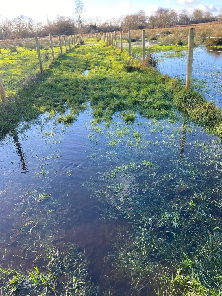
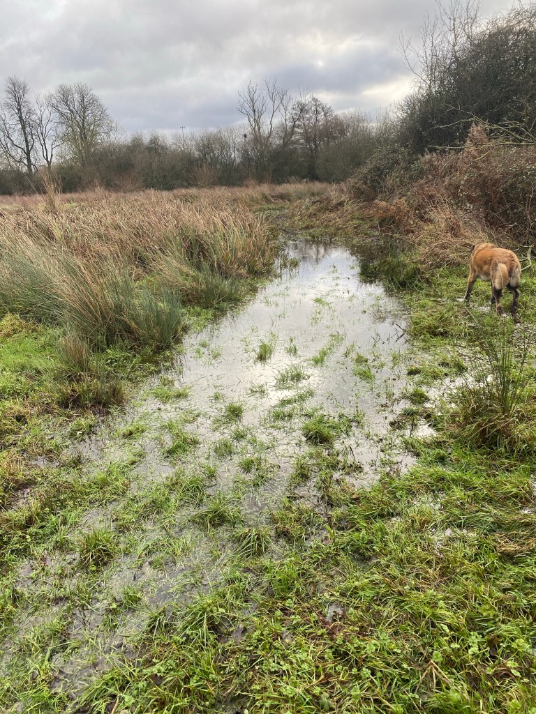
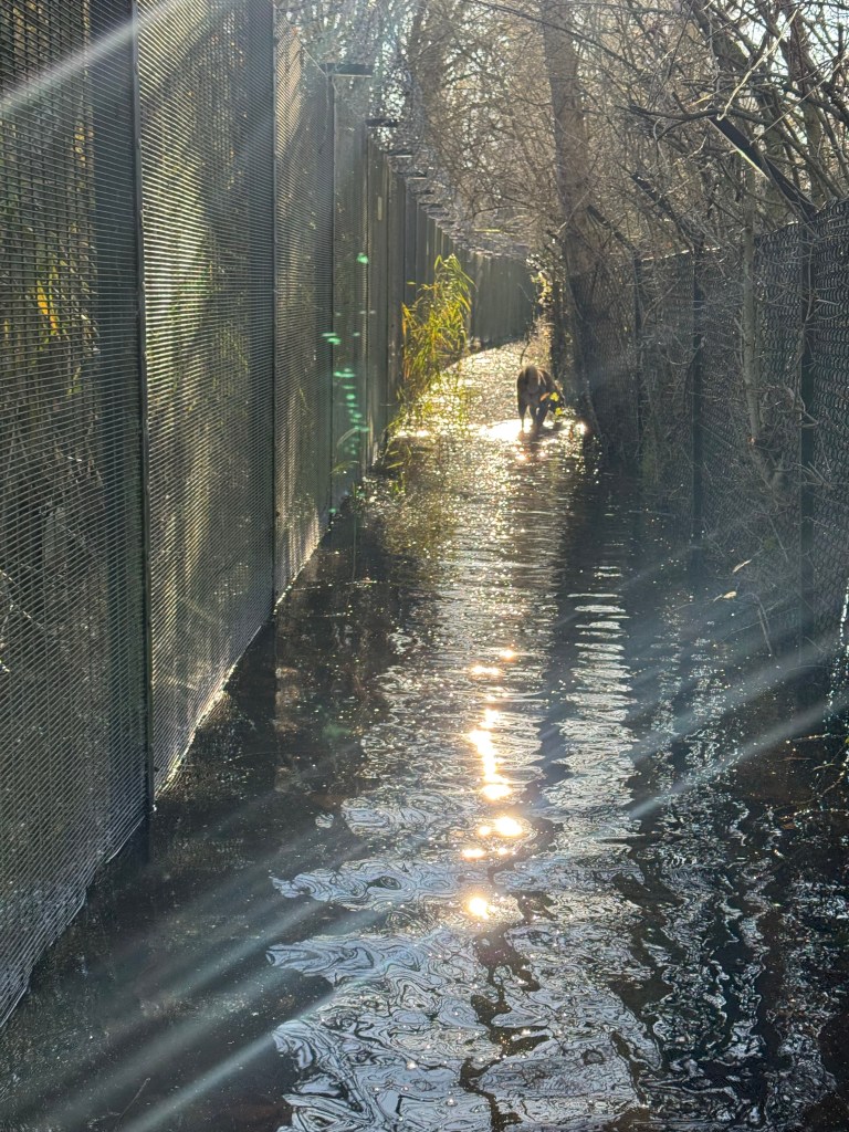
However these are interspersed with a series of lower lying path sections, which render the path unusable some of the time, and accessible to casual walkers much of the time, by water lying in puddles. In several places it is deep and muddy and treacherous.
A significant rainfall event to the west can see the meadows become flooded a day or so later. The nature of the flooding makes using this route unpredictable. After a serious storm the level rises to a point where some of these sections become hazardous.
Given that Coley is a major residential area its reasonable to assume a lot more people would walk here if the condition was improved. To the west lies a similarly oriented path that runs south from Southcote to Southcote lock. Footpath 5.
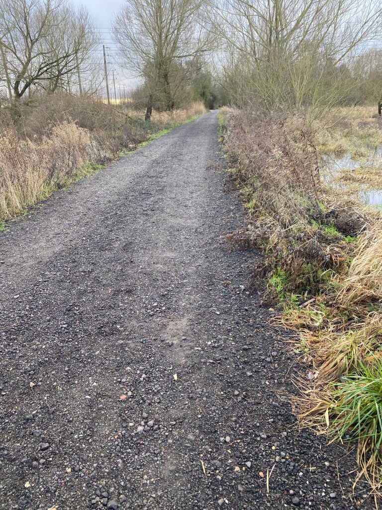
It is a broad track raised above the floodplain. As a result the number of walkers is far higher than seen on footpath 6. Even in extreme flood events it is passable by people in wellies. There are no hazardous areas.
If footpath 6 was a similar level, albeit much narrower, but with a grassy surface, (footpath 5 is broad due to accommodating vehicles) it would facilitate more casual visits, more enjoyment of the meadows, and provide a pedestrian link to Island road, Green Park, the football stadium.
This is why investment in the path surface itself and the height of the path in order to make easy access possible much of the year and safe access for people with wellies should be a priority.
However the path should not be over-engineered. It needs to blend into the meadows, which are an important cultural asset.
I don’t know where to start with this. It’s an ancient path crossing the meadows between Coley and Fobney. So if I start at the beginning, that has to be the northern end. Because in 1496 John Vachel, landowner killed a monk in a fight over access to the meadows. This is a very old and long disputed path. 500 years later the path disputes started to get resolved as a box arrived at the council office, one of 36, each with the historical evidence on 36 footpaths. Footpath 6 was simply a number on one of those boxes. I had the job of adding them to the definitive map, the legal record of rights of way.
So the first dispute was at the northern end and the last dispute at the southern end. Thames Water objected to the path being opened up through the water treatment works. The council’s evidence indicated that a path existed here before the works were built, before Thames water existed, even before the canal was dug, in fact 42 years before Reading abbey was destroyed by Henry 8th.
Reluctantly they conceded that our evidence was pretty good, dropped their objection and opened the gates. That was at 10 am one day in October and I had cycled over to enjoy being maybe the first person to ever ride over it. Sadly it was flooded just to the north and remained inaccessible until March. Anyway back to the path:

In winter it’s an inviting looking trap. Pretending to be a path.
Not long after you head south you come to the first “puddle” It’s almost knee deep but if you have wellies you’re lured on by the success of making it through. Or you’re lured on by fuck it my feet are wet now.

Then you arrive here, known to one or two people as John Major’s bridge.
John Major was a huge man, his stature was reminiscent of the power and gentility of a silverback gorilla. He had a business with his sons, Glen and Dave. JGD. Or as John told me, Jobs Get Done. They made a lot of improvements to the footpaths in the meadows for a few years between 2000 and 2006. He built a bridge further along the path, and as “we” (the council, where I worked as a Rights of Way officer) were spending money from the transport budget and even back then they needed to be spending money on people walking. So we often squeezed out an extra job or two when JGD were on site and he filled in the ditch with gravel and put a pipe under the gravel. So it isn’t really a bridge. Only John Major would suggest this as a neat little solution to an actual bridge, which was more than the budget would stretch to.
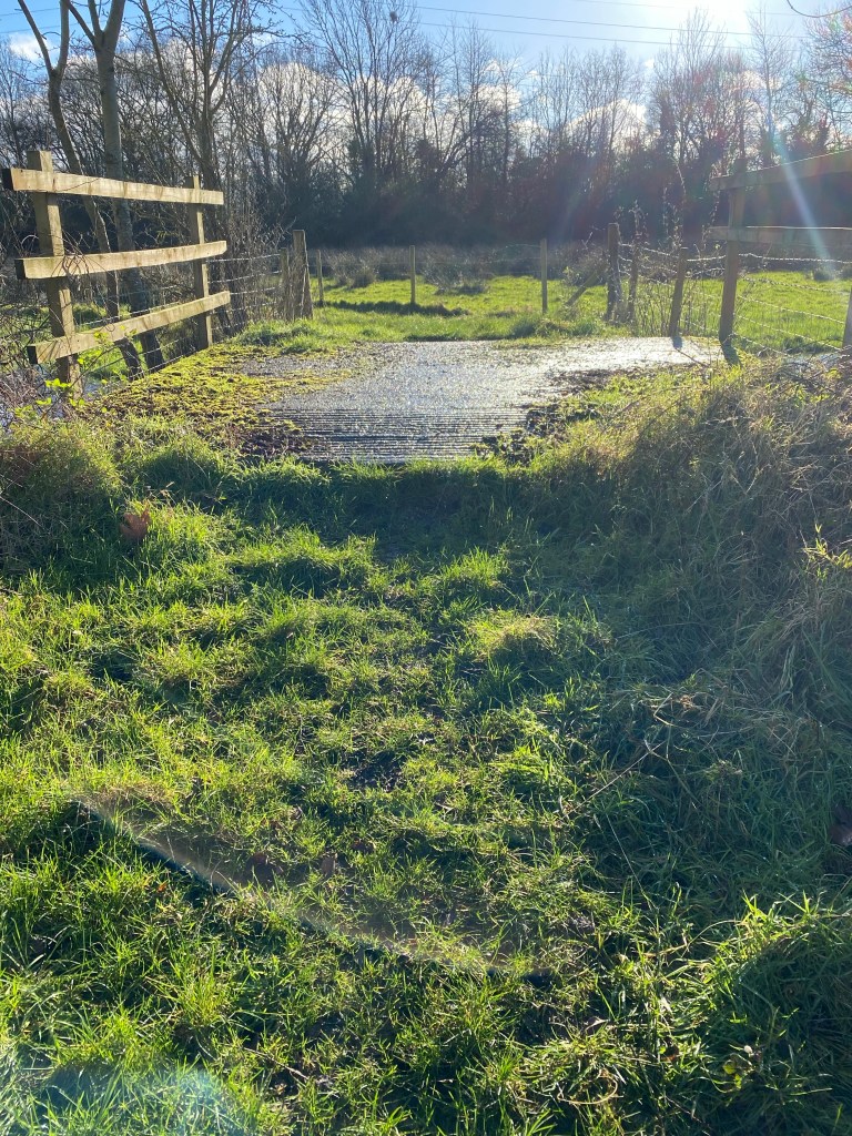
The path here is lovely, a firm grassy surface and clear of the floodwater, and passes over an old farm access bridge.

And then things start to get a bit nautical. There’s quite a bit of water, but it seems as if the tides have pushed some flotsam along the path.
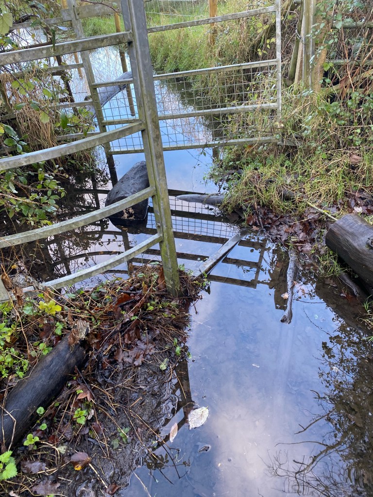
And who knows what lurks beneath. Bricks, logs, leg sucking mud, blood sucking leeches? Most of this is material found by people to throw in the deepest puddle in an effort to make it shallower.
You could easily escape here by scrambling up the bank into the old abandoned railway line. So long as you were physically able to clamber up the steep bank. That’s the Coley Branch line. I’ll come to that a bit later.

This is where footpath 6 goes. Underneath the railway and on across the marsh.

You can see the path ahead. It’s obvious. It’s the bit of the meadows that’s underwater of course!
There’s no chance of getting lost. As the path curves beyond an old bit of a hedgerow the way becomes obvious again
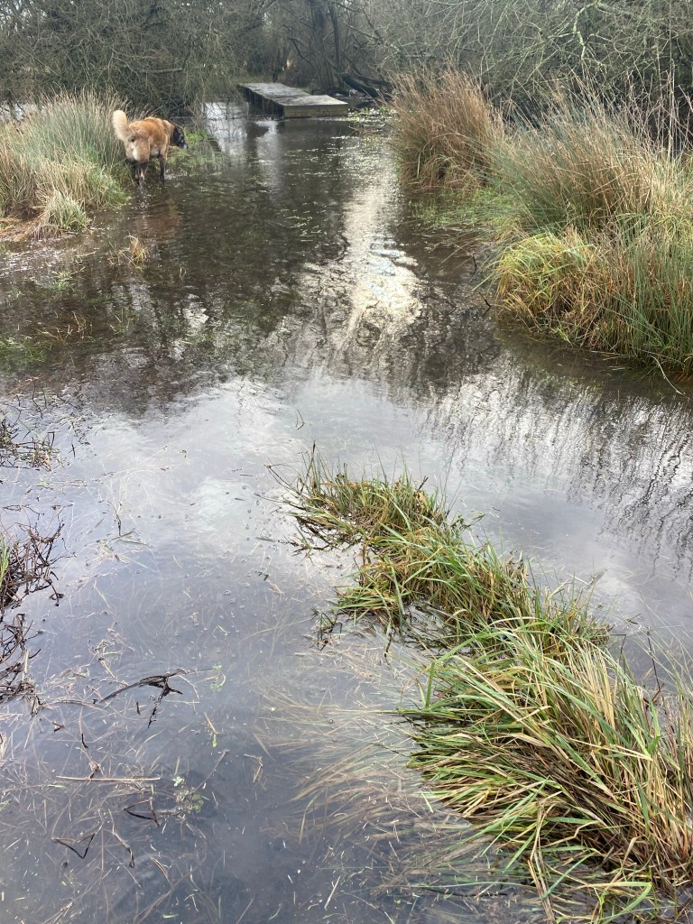
In the distance there’s land, it’s clearly an island and as the water deepens you’re lured into the most evil trap of all. The closer you get to the island, the deeper the water gets. And you know that if this carries on you’re getting wet feet. Again probably.
Amazingly just as you get close to what is now obviously a wooden walkway the water gets shallow and the mud gives way to a hard surface on the soil beneath the water. Phew.
The boardwalk spans an old ditch, possibly medieval, one of two. Over the second bigger deeper and faster flowing ditch is another bridge, this one John Major did build. Cunningly he built one nice bridge where really there should have been two. The original path had two, and they had long rotted away. but by moving the line of the path east a few yards we could have just the one. That and his non existent bridge.
He also somehow dragged an enormous steel and concrete deck and lay it in the ditch as a temporary way across. Sadly he passed away and I left the council. So until we built the boardwalk over his concrete slab, nothing got done, as nobody could move it. Nothing got done anywhere else on the path either, due to inertia.
All that happened was the deck sinking inexorably into the swamp.
One year, 2018? I managed to persuade Councillor Rowland for a visit. She arrived with a retinue of officers which included my former boss, who was a really lovely guy. She had about an hour before she had to be at a meeting with the retinue and others. They weren’t all there because of footpath 6.
When we arrived at the concrete deck it was partially submerged and tilting. I led the way and turned half way over to guide Cllr Rowland across.
Just as she fell sideways into the ditch.
Instead of her I was looking straight at my old boss, and he was looking straight at me. I could see his face. He looked like a slow motion frightened gold fish. Her dark blue camel hair coat, her intricately patterned silk scarf, and her expensive looking handbag were half covered in the Fobney mud. Ben (my former boss) said after that I looked like I was trying to suppress bursting out laughing. At least that would get the footpath fixed I thought. Another of my failures in judgement.
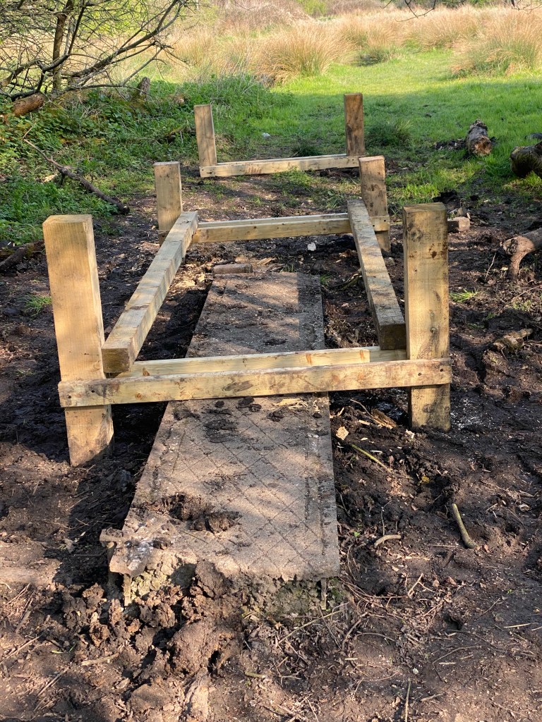
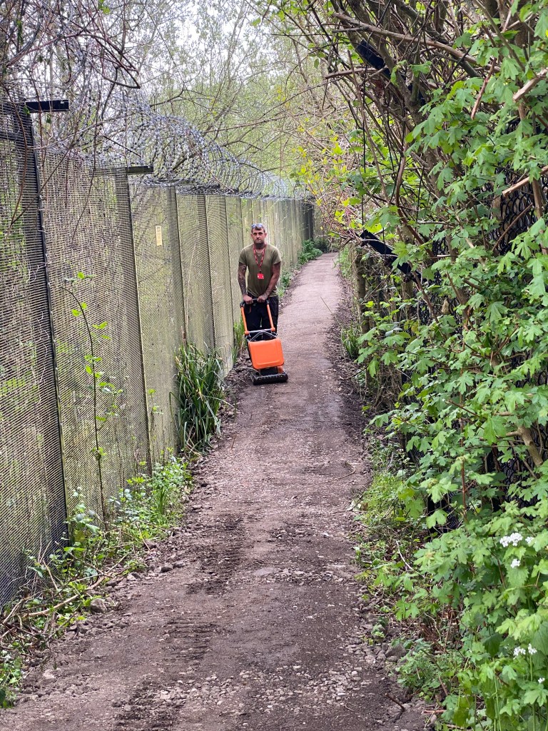
In April 2022 with lottery funding and the Berkshire ornithological club as fund managers a couple of locals organised the boardwalk and path construction. The contractor who built it turned up to get their vehicles into Thames Water works looked over the marsh and found 2 Black-Winged stilts. A very rare species of bird. I don’t think they had ever been seen in Reading before. Hundreds of birdwatchers used the footpath to get to see them. They beat down the vegetation so the council could forget to maintain it again but nobody really noticed for a while.
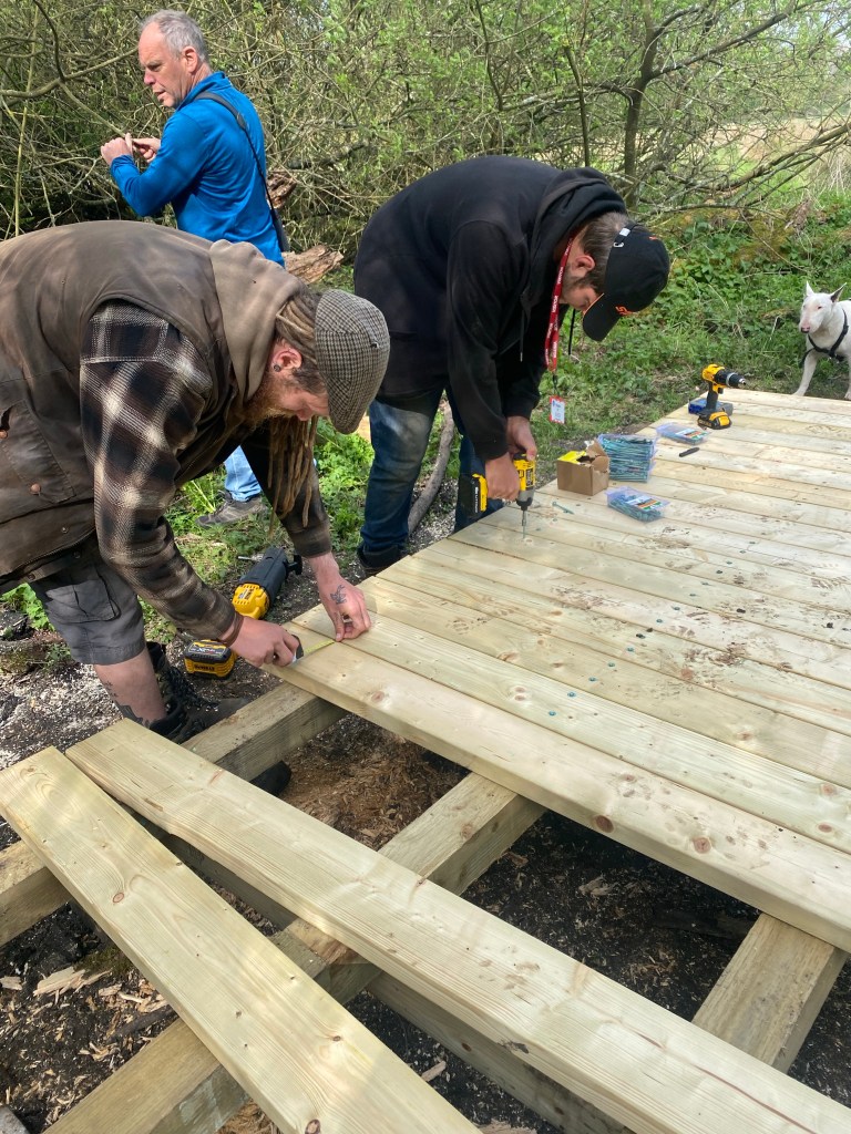
The boardwalk was such a success. That and a length of surfacing at the southern end dramatically improved the path, and the numbers of people who walked it went right up.
Almost all the people were locals and they walked there more and more. I got to know many more people over the following couple of years. We would soon need stilts though. The path became neglected and with the almost random periods of wet weather it would suddenly become impossible to walk the length of it. And if you can’t get from one end to the other it’s a pretty pointless path and soon gets even more neglected.
The southern end of Footpath 6 is where it joins the Kennet and Avon canal towpath at Fobney lock.
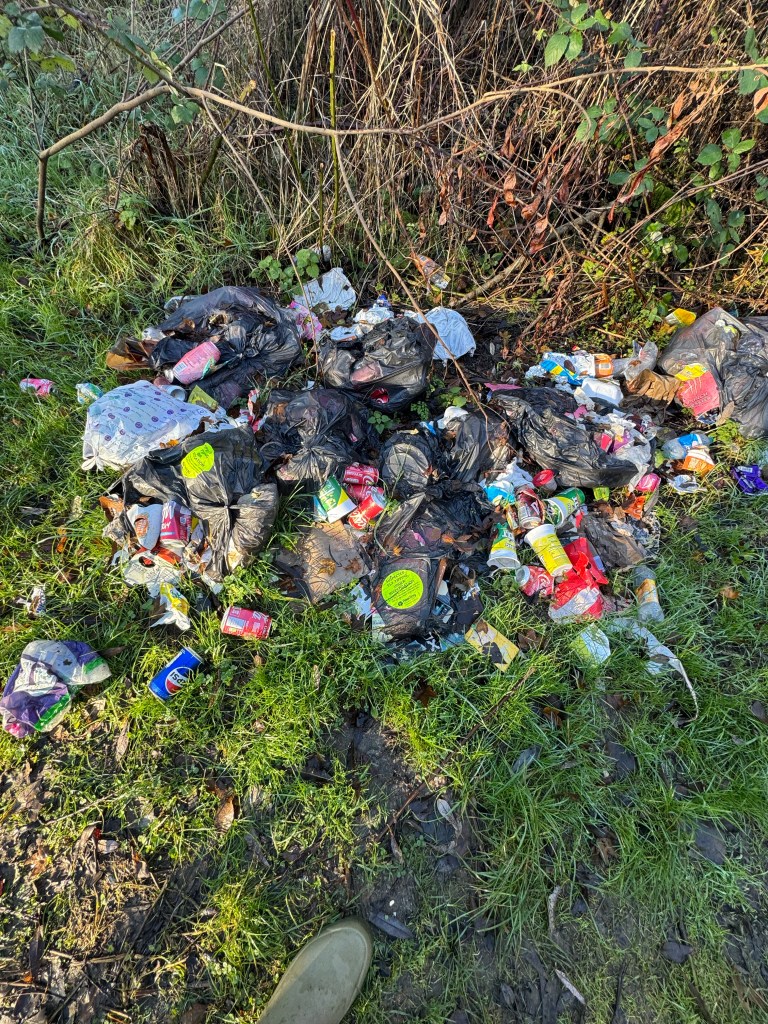
Often the path is marked by litter, as the council won’t touch it because it’s Canal Rivers Trust and CRT won’t touch it because it’s a council issue on a right of way. Or something.
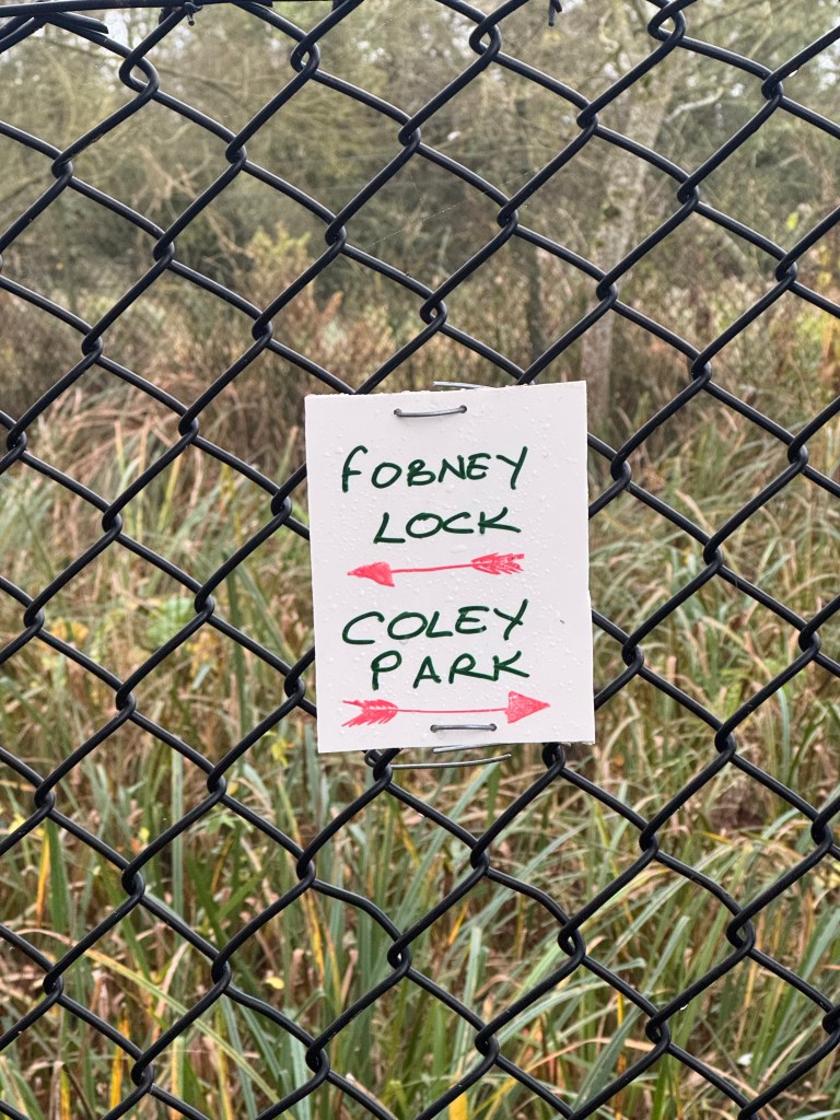
There’s no sign any more so few people venture that way. I thought of putting up a “It’s a Trap” sign. Instead I put a little sign up as the council haven’t. Or won’t.
There is hope though. a couple of years ago the council published a Rights of Way Improvement plan. I’m sure there are few paths more in need of improvement.
From Southcote to the canal at Southcote lock is a wide well surface path. It’s really popular and you almost never need wellies. Occasionally you do but it’s when there’s an enormous flood and the whole area is best avoided. It’s parallel to footpath 6 (it’s called footpath 5!) and people are using it day and night, winter and summer. It’s half a mile to the west.
So why is the Coley park to Fobney lock path so neglected and unloved? It serves the same purpose but has even more potential. It links Coley to Fobney, Green Park, the football stadium and all the retail parks, the Tesco sorting depot, and Kennet Island. Surely it deserves some upgrade.
Well even though it’s identified in the Council’s Rights of way improvement plan, it’s too difficult to do anything. The council staff assume that because it’s in the flood plain it can’t be raised up.
It can.
Circuit lane is raised up. The A33 is on a huge embankment. Footpath 36 (along the banks of the Holy brook) is raised up. Footpath 7 was raised up twice in recent times to make it accessible. They just need permission or exemption from the Environment Agency.
They also don’t have any money. It’s a standard refrain.
Of course they have money. They have tons of money. They’re spending £9 million on road resurfacing. They’re choosing other priorities.
And anyway they’ve just released £50,000 for Kennet Meadows footpaths. When pressed on what they’re going to do with all that money after a few weeks I got this response:
“I have checked with the council team and they are waiting until the early spring to walk the PROWs (when it’s a bit drier!) and assess the work to be done with the 50 thousand funding.
They have also pledged to work with the various local groups to arrive at the best solutions.
This will include on site walks and consultation so hopefully this will happen in due course and your views and expertise can be taken into account”
To which I replied:
“I think a walk by your PROW people when it’s wetter would better discover the problem areas.
As you have already adopted the Rights of Way improvement plan don’t you already know what needs doing?”
I walked all the footpaths in the Kennet meadows in Coley and Southcote on a day when water levels were quite high but not abnormally so. Nothing needs fixing like footpath 6 does.
I feel like asking people to write to Cllr Gittings
It was he who pledged to work with us and who wrote to me.
paul.gittings@reading.gov.uk
I might also suggest writing to Cllr Liz Terry. She’s the leader of the council, she’s ward councillor for Coley and she championed the release of the funding.
liz.terry@reading.gov.uk
Cllr John Ennis is the councillor who is the lead councillor for Climate strategy and transport. No finer champion of walking and improving access.
John.Ennis@reading.gov.uk
https://democracy.reading.gov.uk/mgUserInfo.aspx?UID=148
If one person wrote to them they might just assume he’s sick.
And if two people wrote to them they would just think they’re both sick
And if three people wrote to them they might think it’s an organisation.
And if 50 people, can you imagine 50 people writing to the councillors? Well they might think it’s a movement. And that’s what it is. It’s the Footpath 6 improvement movement.
